Pages

Monday 29 October 2012

OSGeo Incubation the Start of Something Spatial

This is my last Latinoware 2012 post (indeed the talk closed out the conference) and arguably the one I am most passionate about. While I am comfortable talking about GeoTools, GeoServer and the ambitious OSGeo Live project they are all concrete projects, you can sing your teeth into and see an obvious benefit.

But what about the Open Source Geospatial Foundation itself? There have been a number of very good takes on the value of Foundations in fostering open source:
We also have both the Eclipse Foundation and Apache Foundation are casting their eye towards engaging spatial. Raising the excellent question (which our board has been wrestling with) on where to take our Foundation in the years ahead.
My personal hopes is we can look for ways to collaborate, as our mandate is to foster open source spatial and not draw lines in the sand. We have a precedent with our projects making use of a range of hosting services, and this flexibility offers a real appeal for projects looking for a home.

OSGeo Incubation - Start of Something Spatial

This presentation is my take on the OSGeo and it is unabashed in its "pro project" viewpoint. The basic structure is taken from the OSGeo incubation checklist, but it is really a shout out to projects about the benefits of joining a Foundation (any a Foundation) and why OSGeo should be on their list.
The presentation runs through the expectations the Foundation for joining projects and gave me a chance to talk about what we are trying to accomplish (mostly with respect to trust).


LocationTech Teaser

As part of the User-friendly Desktop GIS (uDig) project I have been watching the LocationTech industry working group set up, and was able to offer a small teaser in anticipation of the group making
its formal debut. 

Latinoware 2012


Thanks for keeping pace with this week of Latinoware 2012 blog posts, normal service will resume shortly:
Once again thanks Latinoware 2012 for having me, and to Rafael Soto for facilitating. I would really like to see a FOSS4G held in the Brasil, especially given the excellent oragisation (and enthusiasm) shown at this event. 

Also thanks to my employer LISAsoft for giving me a a chance to write up my experience. If you are looking into open source spatial, give us a shout.

Saturday 27 October 2012

QuantumGIS and GeoServer workshops at Latinoware

First up latinoware was very well attended (you can see a slice of a group shot below).

From Latinoware 2012

While I have attended a couple of Open Source Developer conferences as a LISAsoft employee in Australia, they tend to just walk the software side of the street.

Latinoware had a great mix of hardware and software hackers. I got to see a 3D printer, with the cost brought down to around $300 to the level where it can be successful in emerging economies. I understand it was using recycled soda bottles for material.

From Latinoware 2012

Another impressive showing was a one laptop per child kitted out with a robot accessory so it could walk around. Literally "logo to go" for the educational system - combing ing the joy of learning program with the ability to stomp around.

From Latinoware 2012

Most of the presentations were packed, and were not afraid to take on deep or scary topics (ie how to build your own bootloader thanks to the google chromebook team). Here is a group with TCP stack frames on screen.

From Latinoware 2012

The workshops at Latinoware 2012 were different from what I expect at a FOSS4G event. We have been scared off running workshops concurrent with the regular program at FOSS4G (as attendees would often ditch presentations for the hands on experience). For Latinoware I understand demographics lean toward a student turn out, leaving the pay-to-play workshops with sparse attendance.

Introduction to Geoserver


I managed to sneak into the GeoServer workshop and take a couple pictures, the workshop was being run by Benicio Ribeiro and Rafael Soto.


Quantum GIS


There was also a Quantum GIS workshop hosted by Luis Lopes. If you peak in the background you can see qgiscloud.com on screen as the workshop gets underway.


It was great to see OSGeo projects represented on the ground at such a varied event.

Friday 26 October 2012

OSGeo Live Latinoware 2012

Moving on from a couple project specific presentations we get onto the hard stuff. Presenting OSGeo-Live is always a challenge - simply because the project is so big! It is also a careful balance between presenting as a LISAsoft employee, and a member of of several of the projects and capturing the vendor/product neutral tone befitting an OSGeo Foundation presentation.

A couple of approaches form past presentations:
  • FOSS4G 2010: This is the original OSGeo-Live talk - with a 90 minute time slot. That was enough time to introduce the OSGeo live project, explore its history as a LISAsoft project gradually opening up to be community driven. Go through different "GIS" software categories - even in an expert crowd such as FOSS4G not everyone will be familiar with disaster relief, or navigation as a software category. Wrapping up with exploring how to use the OSGeo-Live project for education and advocacy.
  • OSGeo Live Presentation: Cameron Shorter cut down the above presentation with a stronger focus strictly on project overviews, and provided a talking script for others to run the presentation at their own events.

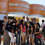
OSGeo-Live at Latinoware 2012


Here are the slides, read below to learn why they are really not the point of the presentation.


I was really happy with the pacing, an hour was just enough time to run this presentation. I tend to run my presentations at two levels (as advocated by Martin Fowler). The general approach is to have two streams of communication, what you are saying and a separate visual stream that supports what you are talking about.

The OSGeo slides are basically a solid wall of text, so you may wonder what on earth I would talk about? I am certainly not mean enough just to read slides.

And the answer depends on what the target audience wants to hear. For Latinoware 2012 I was faced with a developer heavy crowd (I asked them before the talk started) who did not have a background in GIS. As such most of the project details, feature lists and so on would be a meaningless snooze fest.


In introducing OSGeo-Live it is important to establish the size (massive) and scope (international) of the project. So while there is no way to read the individual contributors they can lend weight (of numbers) to the introduction.

Of course I did need to answer the obvious technical questions at a Linux heavy conference (yes it uses XUnbuntu) the important point is what the project is useful for, backed up with a successful history of releases and events.


In this context I needed to introduce what mapping and GIS was all about. As such I leaned heavily on the software categories used to organise the OSGeo-Live project. While my bullet points were mostly useless, they gave me something to show when setting expectations for the available software.


With the sheer number of OSGeo-Live projects (50!) and only an hour to present I was left with some tough choices. The individual projects still provide value to the presentation, if only by weight of numbers, but I would not be able to communicate a meaningful difference in the available time. I decided to use the OSGeo nature of this presentation to my advantage, and only provide a discussion on the much smaller number of official OSGeo projects. This gave me a chance to explore some projects in more detail and give a flavour of what the particular software category was all about.


For each of the OSGeo projects I was often able to tell a story, reflecting back on the Foundation, the project community or both:
  • For deegree I was able to talk about the importance of standards, and their involvement with INSPIRE
  • Perhaps the nicest story was for QuantumGIS where I was able to point out the OSGeo Chapters acting as project sponsors to fund specific features. This is an excellent engagement model for the Foundation and shows an amazing community
  • Speaking of engagement models, for OpenLayers I was able to talk about the recent OpenLayers 3 funding push
  • For Geomajas I was able to describe the migration from javascript to GWT (even just for technical interest).
  • For GEOS I was able to talk about what a Geometry is and what developers need to get going in this area
  • I did take some time out to talk about our criss management category, especially given the recent floods in the area.

Note this is just the approach I used for a developer focused, non GIS conference. As illustrated by FOSS4G 2010 and Cameron's presentation this material can be thrown around for an experienced GIS crowd as well.

OSGeo-Live for Advocacy and Marketing


In terms of Advocacy we need to reach back, before the OGC standards, and introduce basic GIS concepts. A point I specifically had to make to the developer heavy crowd at FOSS4G was that maps are fun and important.

In order to play in this area developers need to select both a representation of geometry, and a technique for referencing that geometry onto a real-world location. While I was able to use the GEOS project to tell this story, I keenly felt the lack of JTS as a talking point.

Suggestions: Include JTS on the OSGeo-Live project overview. I was able to write up a jts_overview page on the airplane back, and this mornings OSGeo-Live meeting is looking to schedule including the visual test-runner program pictured below.


Suggestion: The project category slides from the above presentation are a nice minimum that could be added to the OSGeo-Live documentation. Beyond that it would be nice connect with an education sponsor and arrange a couple of "intro to GIS" tracks that can be run directly out of OSGeo Live. This would be a similar collaboration to how OGC standards are described, however a strong education partner is needed to gather the basic explanation angle that projects continually fail to deliver.

On a project by project basis there are a couple important aspects that are missing from the OSGeo live story.

  • Love: Tell me about the volunteers that are behind a project. In a large part the community is what your are buying into when choosing a project. There is a vast difference between a popular project like QuantumGIS (most downloads from OSGeo servers) and specific tools as the TEAM Engine (which just joined incubation).
  • Money Tell me who is paying. It is both polite to thank sponsors for their contribution, and am important information for those considering a project. Even if a project does not meet your feature checklist out of the gates, if the project is popular in your industry it may be a good fit (as its future direction should align with your long term needs).

We also need to keep in mind that the OSGeo Foundation (and thus OSGeo-Live) needs to remain vendor and project neutral. OSGeo-Live is a tool to promoting the grand adventure that is open source spatial software.

Suggestion: List the the PSC members, followed by organisation. This is done for Eclipse Foundation projects and provides a good indication of who is involved, and who is paying their way.

Suggestion: Not quite sure how to thank sponsors tastefully in the context of OSGeo Live. The State of GeoServer talk also does an excellent job of connecting sponsor logos next to the feature they contributed to (thanks to Justin and Andrea for this classy move). This is an important story to tell and one OSGeo-Live needs help with. Idea: Ask each project overview to include a "sponsors" link much like is done for "support".

Thanks


Thanks to Brian Hamlin for reviewing the slides prior to wider internet distribution. A consequence of gathering material from previous presentations was working with an out of date contributors and sponsors list.

Thanks to Latinoware 2012 for having me, and to Rafael Soto for facilitating (and being such as champion for OSGeo in Latin America).

From Latinoware 2012

From Latinoware 2012

State of GeoServer 2012

And now for the Latinoware 2012 presentation people actually came to see - the State of GeoServer 2012. Once again the content is CC by Attribution and build on earlier talks.


The talk raised a lot of questions, both directly after the talk and in the breaks between presentations. The questions all came down to catalog service web support - and what it means for GeoServer 2.3.

I also got to play the careful balancing act between representing GeoServer (as PSC) and representing the Open Source Geospatial Foundation (ie product neutral). There is still a lot of confusion around how to evaluate and select open source projects for an successful engagement.

The most appropriate course of action is to engage with the local community - a major strength of the OSGeo Chapter setup.


Once again the important status update is the release of GeoServer 2.2. This release was a long time coming and improves major headline features, and important changes under the hood.

Recent activities covered by the presentation:
  • Time Boxed Release once again this a deep change that will effect the developer community, our customers and how end users of the application work with GeoServer.
  • Catalog Service a very simple catalog service, used to publish the GeoServer contents out via CSW. This should allow for easy harvesting by full featured products such as GeoNetwork. The initial service is working, but I expect more funding will be required based on the enthusiasm shown online and at events like Latnioware.
  • Sensor Observation Service currently under construction
  • OSGeo Incubation

From Latinoware 2012

State of GeoTools 2012

Here is the State of GeoTools 2012 talk presented at Latinoware 2012. My first speaking slot was devoted to a "State of Geoserver" and "State of GeoTools status update. The slides are CC by Attribution and build on earlier talks.


The talk was well received, it is however pretty brutal to start off your conference engagement with a set of technical talks. I got the feedback that all my jokes were funny which is always nice and hopefully softened the content a bit for those present.


The big status news for GeoTools is of course the release of GeoTools 8 with all its headline features.

It is worth pointing out a few recent developments covered by the presentation:
  • Process, Process, ProcessWeb Processing Service is finally attracting funding, with it comes a lot of new process ideas, implementations and directions. Hold on it is going to be a wild ride!
  • Prep for Java 7 try-with-resource Update our API to mark which items are “Closable”
  • FeatureCollection as a Result Set For Java 5 we needed to prevent FeatureCollection extending java.util.Collections - so that iterators could be closed.
    We are completing this work by removing the deprecated method names (add, remove, etc...)
    This will allow FeatureCollection to be a simple result set.

And the change that is likely to have the most lasting effect: switching to predictable release cycles. This is already being noticed with GeoTools 8.1 and 8.2 being released in September.

From Latinoware 2012

Friday 19 October 2012

Latinoware 2012

I have put up a set of Latinoware 2012 Photos up (and a few more covering a trip to the Itaipu Dam).

I am so impressed with the organisation and sheer scale of Latinoware 2012. Over morning coffee I was introduced to the idea that they try and grow a little each year in order to be the biggest open source conference.

At over 4000 people they must be getting close! The organisers have pressed a legion of buses (drawn from the local tourist trade) to facilitate. There are people everywhere, and all very happy, this place is humming along!

I am scheduled for a couple of talks tomorrow afternoon on GeoServer/GeoTools, OSGeo Live DVD and OSGeo Incubation. Wish me luck.

Aside: I have been asked to encourage others to attend, apparently because the large number of beautiful women working in IT here. So while I will pass that on at face value, anything we can do to help balance out our industry is sorely needed, consider setting up a Girl Geek Coffee in your area.


Latinoware 2012

Dam Trip

Sunday 7 October 2012

FOSS4G-AU un-conference

The FOSS4G-AU local chapter is back (after going all out for foss4g 2009).

Ben Caradoc-Davies announced the following last week:
The Free and Open Source Software for Geospatial Australia (FOSS4G-AU)
2012 Unconference and Code Sprint will be held at CSIRO’s Queensland
Centre for Advanced Technologies (QCAT), Pullenvale QLD.
  • 15 November: Unconference
  • 16 November: Code Sprint
This is a participant-organised event: please add your unconference and code sprint topic suggestions to the wiki. Organisers are welcome; please speak up. 

See here for details: http://wiki.osgeo.org/wiki/FOSS4G-AU_2012

RSVP essential for building access. Please sign up here:
http://www.meetup.com/osgeo-aust-nz/events/83965312/

Email: aust-nz@lists.osgeo.org (sign up here http://lists.osgeo.org/mailman/listinfo/aust-na)

Kind regards,
Ben Caradoc-Davies
Software Engineer
CSIRO Earth Science and Resource Engineering
Australian Resources Research Centre

Looking forward to seeing you there.